



Gokyo Lakes Trek 2026: Routes, Passes and Acclimatization
A complete 2026 guide to the Gokyo Lakes trek: route choices (out‑and‑back, Cho La, Renjo La, or a two‑pass circuit), realistic day‑by‑day itineraries with sleeping altitudes, acclimatization advice, permit and guide requirements, seasonal considerations, and a comparison with the Everest Base Camp trek.

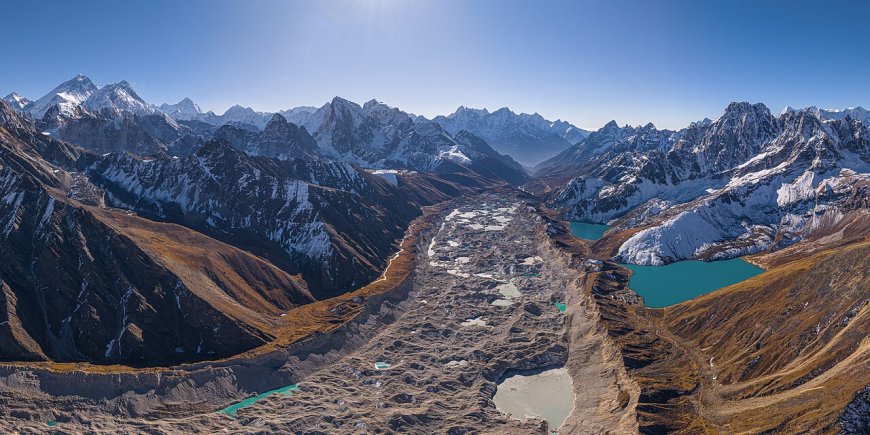
What the Gokyo Lakes trek is and where it sits in the Khumbu
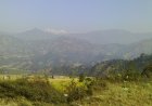
The trail branches from the main Everest Base Camp route at Namche Bazaar, turning west up the Dudh Koshi valley through Dole and Machhermo before reaching the lake basin at Gokyo (4,790 m). From there, Gokyo Ri rises as a rocky ridge (5,357 m) offering a panorama that, in my view, rivals the view from Kala Patthar — Cho Oyu, Everest, Lhotse and Makalu all visible in a single sweep. The lake chain is a Ramsar wetland of international importance (Ramsar Sites Information Service, site 1690, designated 2007).
The lakes and the Ramsar designation
The Gokyo lake system comprises a series of oligotrophic lakes fed by glacial melt, strung along the valley floor at altitudes where few permanent settlements exist. The Ramsar listing highlights their significance as a high‑altitude wetland complex; it does not replace the national‑park entry permit or the Khumbu Pasanglhamu Rural Municipality fee.
Route options and the high passes
Three main shapes exist for a Gokyo Lakes trek.
- Out‑and‑back – follow the valley in and return the same way. Simplest logistics, no pass crossing.
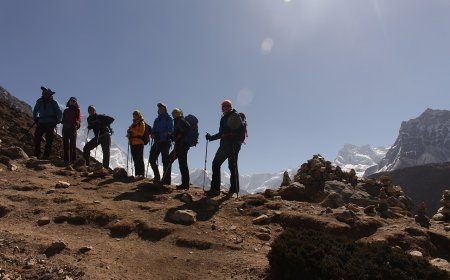
- Cho La variant – continue from Gokyo across Cho La (5,420 m) to Dzongla and rejoin the EBC trail, letting you tag both Gokyo Ri and Everest Base Camp in one circuit. Cho La is a glacier pass; the trail climbs steep moraine, crosses the small Cho La glacier between Thagnak and Dzongla, and often requires crampons or microspikes early in the season or after fresh snow.
- Renjo La variant – cross Renjo La (5,340 m) from Gokyo down to Thame and the Bhote Koshi valley, a quieter exit with dramatic views of the Rolwaling range. Renjo La is less technical but exposed, with a steep final ascent and a long descent on loose scree.
Some itineraries link both passes, creating a full high‑pass circuit that demands strong acclimatization and comfort on glacier moraine. Conditions on both passes vary season to season and even week to week; treat any secondary source stating current status as unverified. If you plan either crossing, assume you need a guide or a group experienced in glacier travel, and build in a weather buffer day.
Itinerary tables
Out‑and‑back / single‑pass (12 days)
| Day | From → To | Sleeping altitude | Notes |
|---|---|---|---|
| 1 | Lukla → Phakding | 2,610 m | Short walk, arrive early. |
| 2 | Phakding → Namche Bazaar | 3,440 m | ~830 m gain; accepted because Day 3 is a rest day. |
| 3 | Acclimatization day – hike to Khumjung or Everest View Hotel | 3,440 m | Climb high, sleep low. |
| 4 | Namche → Dole | 4,110 m | ~670 m gain; many add a night at Mong La if needed. |
| 5 | Dole → Machhermo | 4,470 m | |
| 6 | Machhermo → Gokyo | 4,790 m | |
| 7 | Acclimatization day – hike Gokyo Ri (5,357 m) | 4,790 m | Essential before any pass crossing. |
| 8 | Gokyo → Thagnak (if Cho La) or Lungden (if Renjo La) | 4,700 m / 4,380 m | |
| 9 | Pass crossing – Cho La to Dzongla (4,830 m) or Renjo La to Thame (3,820 m) | 4,830 m / 3,820 m | Allow extra day for weather. |
| 10‑12 | Return via Namche to Lukla | – | Descend gradually. |
Two‑pass circuit (15 days)
| Day | From → To | Sleeping altitude | Notes |
|---|---|---|---|
| 1‑7 | Same as Days 1‑7 above | – | |
| 8 | Gokyo → Thagnak | 4,700 m | |
| 9 | Cho La crossing to Dzongla | 4,830 m | |
| 10 | Dzongla → Lobuche → Gorak Shep (optional EBC) | 5,140 m | Highest sleep altitude. |
| 11 | Gorak Shep → Kala Patthar → Dzongla | 4,830 m | |
| 12 | Dzongla → Thagnak → Gokyo | 4,790 m | Return to lakes. |
| 13 | Gokyo → Lungden | 4,380 m | |
| 14 | Renjo La crossing to Thame | 3,820 m | Long descent; allow a full day. |
| 15 | Thame → Namche → Lukla | 2,860 m | Finish at Lukla. |
Acclimatization and altitude illness
The widely used guidance — not a rule, not a guarantee — is to limit sleeping‑altitude gain to 300–500 m per day above 3,000 m and take a rest day every 600–1,000 m of cumulative gain. The principle “climb high, sleep low” applies on acclimatization days: hike higher than your lodge, then descend to sleep. Symptoms of acute mountain sickness include headache, nausea, dizziness, and poor sleep. If symptoms worsen or you develop ataxia, confusion, or breathlessness at rest, those are warning signs of HACE or HAPE. The only reliable treatment is immediate descent. Do not wait. Do not medicate your way upward. This is general information, not medical advice. The Himalayan Rescue Association posts at Pheriche and Manang run aid posts during peak seasons; CIWEC Clinic in Kathmandu publishes travel‑medicine guidance for Nepal. Consult both before you travel.
Gokyo vs Everest Base Camp: a decision matrix
| Factor | Gokyo Lakes | Everest Base Camp |
|---|---|---|
| Primary scenery | Lake chain, Ngozumpa Glacier, Gokyo Ri panorama | Khumbu Icefall, Base Camp, Kala Patthar sunrise |
| Crowd level | Moderate; thins past Dole | High; constant flow spring and autumn |
| Typical duration | 10–14 days with passes | 12–14 days standard |
| Max sleeping altitude | 4,790 m (Gokyo) or 4,830 m (Dzongla) | 5,140 m (Gorak Shep) |
| Glacier/moraine travel | Significant on Cho La; Ngozumpa lateral moraine | Khumbu Glacier moraine to Gorak Shep |
| Suits | Trekkers wanting lakes, glacier views, quieter trail, pass options | Trekkers focused on Base Camp itself, iconic icefall, higher max altitude |
If you have time and acclimatization capacity, the Cho La link lets you do both. If you must choose one, Gokyo rewards the photographer and the solitude‑seeker; EBC delivers the classic base‑camp moment.
When to go: qualitative season description
Two windows dominate. Post‑monsoon (late September through November) brings clearer skies, stable high pressure, and cold nights — often below –10 °C at Gokyo. Lodges are fully open, flights to Lukla run on schedule more reliably, but the trail is busiest. Pre‑monsoon (March through May) warms gradually; days are longer, rhododendrons bloom lower down, but haze builds through April and afternoon clouds are common. Snow on the passes can linger into April, and flight disruptions increase as the monsoon approaches. Lodge opening, snow cover, and flight reliability all vary year to year.
Pre‑trip checks
- Permits and entry formalities – You need a Sagarmatha National Park entry permit and the Khumbu Pasanglhamu Rural Municipality fee. Confirm the current requirement and fee directly with the Department of National Parks and Wildlife Conservation and the park office before you travel, and check whether your operator includes them.
- Guide requirement – As of 2026, foreign trekkers are required to be accompanied by a licensed guide for trekking in the Khumbu region, including the Gokyo Lakes route and any high‑pass crossings. Verify the current rule with the Nepal Tourism Board or your licensed operator before booking.
- Lukla flights – Flights are weather‑dependent. In recent seasons many flights have been redirected to Manthali (Ramechhap) airport; confirm the departure airfield with your airline or operator when you book and again in the week before travel.
The Ngozumpa Glacier
The trail runs beside the Ngozumpa, a large debris‑covered glacier spilling from Cho Oyu. Its lateral moraine forms the walking surface for hours, crevassed in its upper reaches, and serves as a constant reminder that the landscape is active.
FAQ
- How many days does the Gokyo Lakes trek take?
- A typical out‑and‑back trek needs 10–12 days; adding one high pass brings it to 12–13 days, and a two‑pass circuit is about 15 days.
- How difficult is the trek?
- Moderate to strenuous. The main challenges are altitude (sleeping above 4,700 m), steep moraine sections, and the technical glacier crossing on Cho La.
- What is the elevation of Gokyo Ri?
- 5,357 m (Survey Department, Government of Nepal, 2024 topographic map).
- When is the best season?
- Late September to November for clear skies; March to May for warmer days and blooming rhododendrons, though passes may hold snow later.
- Do I need a guide?
- Yes — a licensed guide is mandatory for all foreign trekkers in the Khumbu region, including the Gokyo Lakes route and any high‑pass crossings.
Internal links for further reading
- Everest Base Camp Trek guide
- Renjo La Pass details
- Cho La Pass details
- Lukla flight information
- Nepal trekking permits overview


What's Your Reaction?