







Langtang Lirung: The Mountain Behind the Valley View
Langtang Lirung is the mountain at the head of Nepal's Langtang Valley, not the trek that shares its name. A short, honest profile: where the peak stands, why so few climbers have stood on it, and why its East Face keeps turning up in expedition writing while staying out of guidebooks.

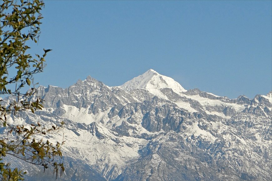
Langtang Lirung is a mountain, not a trail. That sounds obvious until you search for it and find page after page of trekking itineraries, because the peak shares its name with the valley everyone walks through to reach it. This piece is about the mountain: where it stands, why its climbing record is so thin, and what separates looking at it from climbing it.
Where it stands
Langtang Lirung is the highest point of the Langtang Himal, the range that closes the head of the Langtang Valley in Rasuwa district. Kathmandu is a long day's drive south. The Tibetan border is close enough that the northern flanks fall away toward the plateau. The figure you'll see most often, and the one Nepal's official peak profile uses, is 7,227 m; older books and trekking sites sometimes differ by a few metres. If you need a number for anything official, use the government profile, since the permit categories are built on it.
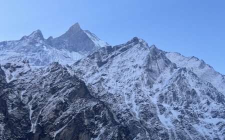
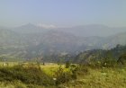
It helps to have the neighbours straight. The peak stands above Kyanjin at the top of the valley, with Langtang Ri and the Kimshung peaks among the summits sharing that upper massif, and Dorje Lakpa marking the eastern end of the same range. From high ridges away to the west, on the Ganesh Himal side, the Langtang peaks line up across the valley on a clear morning. Water on the Nepal side all runs into the Langtang Khola, the river you follow up from Syabrubesi, while streams off the northern flanks drain away toward Tibet.
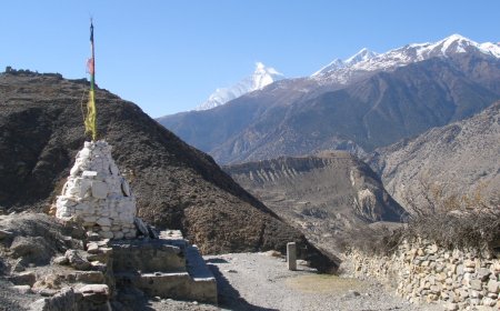
Most visitors meet the mountain from Kyanjin village, or from Kyanjin Ri, the viewpoint a couple of hours above it where the classic photograph gets taken. Looking is a morning and a thermos. Climbing is a permit, a team, weeks on the hill and a great deal of luck with weather.
Why the climbing record is thin
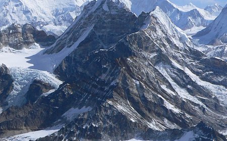
Langtang Lirung is not a peak people stumble onto. Its faces are steep, heavily iced and exposed to serac fall and avalanche from above, and among expedition climbers it carries a reputation well out of proportion to how rarely it appears in trekking itineraries. Ascents are few. The record is scattered across the American Alpine Journal, the Himalayan Database and individual expedition reports rather than gathered in any one tidy place, which is part of why the mountain stays obscure.
Practically every visitor to the Langtang Valley walks past it rather than up it. The trail up the valley is a trek. The summit is an expedition, with the cost, commitment and risk that word implies.
The East Face
The wall that draws the most attention from climbers is the East Face, and it is the reason Langtang Lirung turns up in mountaineering literature far more often than in guidebooks. It is a big, serious piece of ground, rising unbroken from the glacier to the summit ridge, and the attempts and near-misses on it have been written up over the decades. Those accounts belong to the people who were there, so if you want the climbing history properly, start with the American Alpine Journal index and the Himalayan Database. Both are searchable, and both lead back to first-hand reports.
What a climb asks of you
The approach runs through the Langtang Valley. Vehicle access has crept further up from Syabrubesi over the years as the road has been extended, and how far it reaches has shifted with each construction season, so treat any road head named in a book or an old blog post as a starting point and ask locally where the vehicles stop now. Either way it is a walk of several days to Kyanjin and another stretch beyond that to the mountain.
Base camp is not one fixed spot. Location varies with the route and the season: parties heading for the East Face approach from the Langshisa side, while other lines run up the main Langtang glacier above Kyanjin. After that, the mountain sets the terms. Sustained snow and ice, fixed ropes on some sections and none on others, and a summit push that depends entirely on whether the weather gives you a window.
Spring and autumn are the usual windows for Nepal's expedition peaks. Winter and the monsoon are not.
You cannot simply walk up. Climbing in Nepal needs a permit arranged through the Department of Tourism, normally via a licensed agency, and the fee, the paperwork and the office that signs it off have been revised more than once. That is exactly why this page does not quote a number or a procedure: a fee copied from a stale source is worse than no fee at all. Get the current figure and the current steps from the department or your agency, in writing, before money changes hands.
On rescue, plan as though help will be slow. Helicopter access to the upper Langtang Valley depends on weather, on the aircraft's altitude limits and on an operator being free and willing to fly. Talk the specifics through with your agency before you leave, and make sure your insurance genuinely covers high-altitude rescue rather than assuming it does. Nothing here is medical or altitude-treatment advice; that belongs with a qualified expedition doctor.
If you are going to look at it, not climb it
The Langtang Valley trek is a separate thing entirely, and a good one. If the peak is the reason you are walking up the valley, Kyanjin makes a sensible base for a couple of nights, and the climb up Kyanjin Ri gives you the view most people are actually after. Trail conditions, lodge openings and entry formalities for Langtang National Park change from season to season, so confirm the current situation locally or with a licensed trekking agency before you set out.
Sources
Three places do the heavy lifting for anything factual about this mountain:
- Nepal Himal Peak Profile, Government of Nepal, for the official elevation and permit category.
- American Alpine Journal, searchable by peak and year, for first-hand expedition accounts.
- The Himalayan Database, for the compiled ascent record of Nepal's expedition peaks.
What you can take from here without checking anything: Langtang Lirung is a 7,227 m expedition peak in the Langtang Himal of Rasuwa district, the East Face is its calling card, very few people have climbed it, and the view from Kyanjin Ri is not the same thing as the mountain.
What's Your Reaction?