






Ama Dablam Route and Difficulty: What the Climb Actually Asks of You
Ama Dablam route and difficulty explained: the typical camp layout, the Mushroom Ridge and Grey Tower, the abseil descent, permits, and how hard the 6,814 m climb really is.

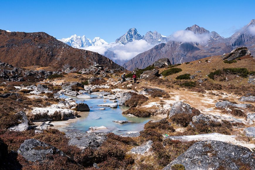
Ama Dablam is 6,814 metres of rock, snow and ice hanging over the Khumbu, and from the teahouse at Pangboche it looks almost polite. Thousands of trekkers see it that way each season on the walk to Everest base camp, and a few of them come back the next year asking what it would take to stand on top. Fair question. The honest answer is longer than a price quote.
One caveat before the details: royalty rates and camp layouts do change, so read those off a dated document rather than a blog. The rest is stable enough to plan around. Ama Dablam is a 6,814 m peak in the Khumbu with two main climbing windows, spring (roughly April into May) and autumn (October into November), and a full trip usually runs between three and five weeks depending on whether you acclimatise on the walk in or arrive already adapted.
Why this mountain draws a queue
Location does a lot of the work. Ama Dablam sits right beside the Everest base camp trek route, so it is probably the most photographed mountain in Nepal that most of its admirers never climb. That visibility builds a reputation.
It is also a six-thousander, which puts it within reach of climbers who are not ready for an eight-thousander but want something more serious than a straightforward trekking peak. That middle position is exactly why it gets busy, and why the summit ridge can feel like a queue on a good day in May.
Then there is the shape. A long ridge, a distinctive hanging glacier, a summit that looks reachable by a fit person with a guide. Worth interrogating that impression before you pay a deposit.
The route: a typical layout, camps and the summit ridge
Almost every ascent follows the southwest ridge. The camp structure below is what a standard itinerary tends to look like, so treat it as a template rather than a promise. Operators differ on how many camps they use and where they put them.
Base camp, around 4,600 m. On moraine below the ridge, a couple of hours above Pangboche, with yaks, a mess tent and a lot of staring upwards. Most teams spend several nights here and do a short carry up the lower slope before moving.
Camp 1, around 5,700 m. Reached by a long mixed slope with rock steps, patches of fixed rope and a snow ramp that changes shape every season. This is the first place the climb stops feeling like a trek.
Camp 2, near 6,000 m. Small tent platforms on the shoulder, exposed to wind and sitting under the hanging glacier. That glacier has shed ice in the past, which is one reason camp placement shifts between operators and between seasons.
High camp, around 6,300 m. Sometimes called Camp 3, sometimes skipped in favour of a longer push from Camp 2. Space is tight, the ledges are small, and you will likely share the night with other teams.
The summit ridge. Above high camp the route follows the Mushroom Ridge, a line of snow and ice formations that give the ridge its name, then the Grey Tower, a mixed rock-and-ice step that is often the slowest part of the day. Above it the angle eases to the summit at 6,814 m, with the hanging glacier below and Cholatse and Makalu in view.
The descent. This is where the day is really decided. A long series of abseils takes you back down the ridge on fixed lines, in the cold, with tired arms, often behind other teams waiting their turn. Most incidents on Ama Dablam happen on the way down rather than on the way up.
How hard is Ama Dablam, really?
Harder than the photographs suggest, easier than the scare stories, and neither of those is a useful benchmark. Guidebooks commonly grade the southwest ridge around AD, which tells an alpine climber something and a fit trekker almost nothing.
Ama Dablam climbing difficulty is better judged against specific demands than a letter grade. Have you climbed above 6,000 m and slept at that height? Can you move confidently for hours on steep snow and rock in crampons, clipped into a rope? Have you done a long series of abseils on tired legs? Do you know how your body acclimatises, from experience rather than hope? If the honest answer to most of those is no, the mountain will still be there in two or three years. Peaks like Island Peak and Lobuche East exist precisely to answer those questions before you commit to a bigger objective.
Conditions move the difficulty around too. Snow depth, how many teams are ahead of you, whether rope is already fixed, and how well you personally have acclimatised all push the same climb up or down. Any single rating is a starting point.
Timing, and how long the trip takes
Spring and autumn are the two windows. Spring trips usually run from early April into mid-May, with more teams, more fixed rope already in place and more traffic on the ridge. Autumn, roughly October into November, is quieter and colder, and the ropes may not be in place when you arrive.
Length depends on your starting point. If you fly to Lukla and walk in through Namche to acclimatise, a realistic schedule is four to five weeks, including the trek, rotations and weather days. If you arrive already adapted, fly to base camp by helicopter and move fast, three weeks can work. Cutting any closer than that usually means paying for a helicopter ride you did not plan on.
Build in spare days. Ama Dablam's summit window can close for a week at a time, and operators who schedule no buffer are scheduling your disappointment.
What to get in writing before you pay
Ask for the following, from your operator, with a date on the document:
- How many camps above base camp you sleep in, and which ones you only pass through.
- Which sections carry fixed rope, and whether your team places it or arrives after another team has.
- The guide-to-climber ratio on the summit push, not on the approach trek.
- The rotation plan: how many trips up and down, and to what height, before the summit attempt.
- Where the abseils are on the descent, and who controls the rope on them.
- Their minimum experience requirement, stated as a fact rather than an attitude. If the reply is “good fitness and a positive mindset”, ask again with a direct question about previous altitude.
Those answers move the difficulty more than the mountain's height does. Hours clipped to someone else's fixed line is a different proposition from leading on your own protection. A team that fixes its own rope is doing work that a team following behind is not.
Permits: which office issues what
Ama Dablam normally runs as an expedition peak through the Department of Tourism, which maintains the official mountaineering peak list and the royalty schedule that sits alongside it. The Nepal Mountaineering Association holds a separate catalogue of trekking peaks, the group that includes Island Peak and Lobuche East, and issues permits for those.
Classification can change, so confirm rather than assume. Ask your operator for the peak's category, the royalty amount their price is built on, the office the permit is issued through, and the date they last checked. Cross-check against the Department of Tourism's mountaineering pages and a current operator itinerary; our Nepal climbing permit guide covers the general process. Where the sources disagree, plan for the disagreement.
Reading the season's reports
Every spring and autumn brings a wave of numbers: permits issued, rescues, summits. Read them carefully. A permit count is not a headcount and not a count of people who reached the top. Mid-season totals are provisional because the season is still running when the article is written. A report that names a cause tells you more than one that only names a rescue, and headlines sometimes fold separate events into one story, leaving an impression no single report supports.
What you can take from all of it: the mountain is serious, the descent is where people get caught, and preparation is not a formality. Then go and read the current documents, write down the date you checked them, and book with someone who can show you the same.
What's Your Reaction?