










How Hard Is the Annapurna Base Camp Trek? Altitude and Terrain
The Annapurna Base Camp trek isn't technical, but the constant stone steps, the cold above the treeline and the thin air in the last two days make it moderate to hard. This section-by-section breakdown covers what each stretch actually demands, where altitude symptoms tend to appear, how itinerary length and jeep or helicopter shortcuts change the risk, and why crampons can matter outside the main seasons.

How Hard Is the Annapurna Base Camp Trek? Altitude and Terrain
The honest answer to the Annapurna Base Camp trek difficulty question depends on which part of the route you mean. This is not a technical climb. You walk into the sanctuary and stand at base camp at roughly 4,130 m on your own two feet, without ropes. It is also not a gentle village stroll. Most of the difficulty lands in three places: the constant up and down on stone steps, the cold and exposure once the forest runs out, and the thin air in the last stretch. Knowing where each of those bites makes the decision a lot clearer than any single star rating. If you have not settled a plan yet, our Annapurna Base Camp trek itinerary shows how the days are usually split, and the permits page covers the paperwork you need before Nayapul.
Is ABC hard? What makes this route difficult, and what doesn't
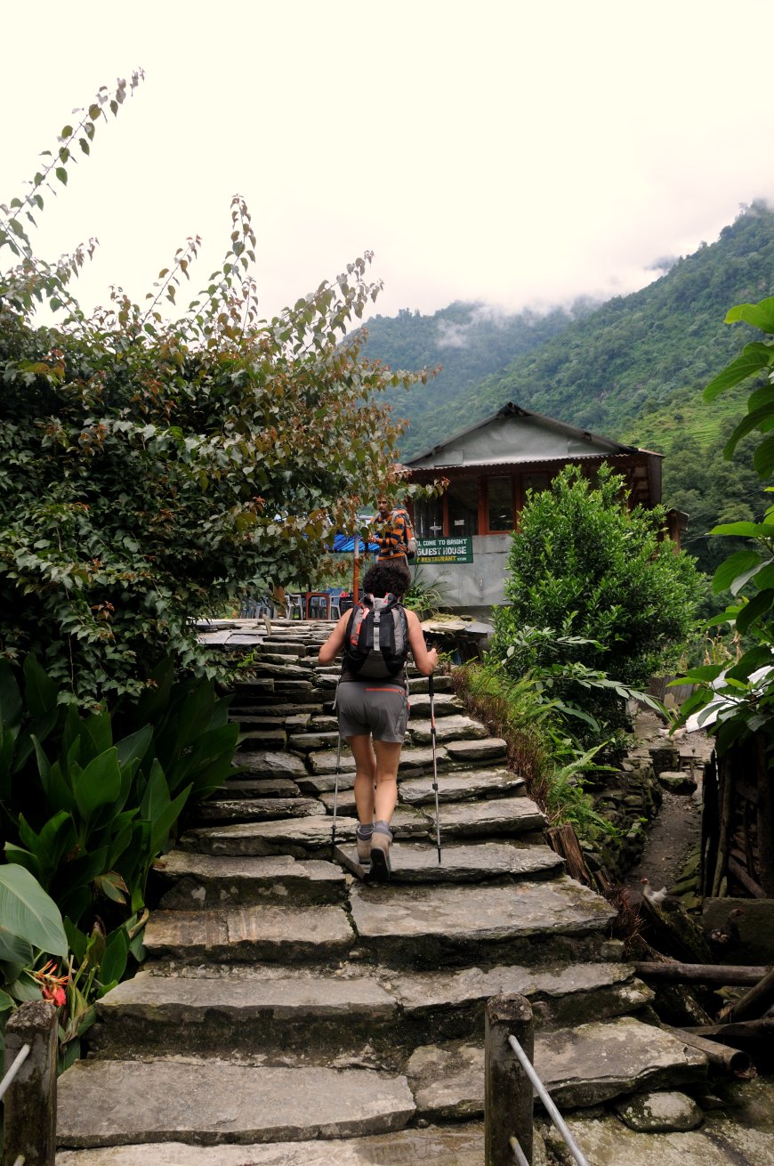
There is no glacier travel and no scrambling on fixed ropes. The trail is a walk, on dirt, rock and an enormous number of stone stairs, through villages, farmland, bamboo forest and finally open moraine. In the main trekking seasons, roughly March to May and late September to November, nobody needs ropes, crampons or an ice axe. That changes outside those months: in winter and early spring, microspikes or crampons are routinely carried for the Deurali to ABC stretch and across the moraine, and after fresh snow guides will often insist on them.
The gap between "any reasonably fit person can do this" and "fit people still find it demanding" is explained by the shape of the route rather than one brutal day. You climb, you drop into a river valley, you climb again. The steps work your legs in a way flat walking never does, and the descent is often harder on the knees than the ascent. Fitness requirements are moderate rather than extreme, but they assume you can be on your feet most of a day, repeatedly, with a light pack and cold bedrooms at the end of it.
How many days you take changes the difficulty more than anything else
Most trekkers walk in from Nayapul or from Siwa (the jeep road above Ghandruk) and take somewhere between 7 and 12 days return. Seven is fast, doable for some but it stacks long days right when your legs are still adjusting. Nine or ten is the comfortable middle. Twelve gives you buffer for weather and a slower push above the treeline.
Short versions matter here. Jeep transfers to Chhomrong or Jhinu Danda, or a helicopter out from ABC, cut the walking but not the altitude gain. You can be at 3,700 m a few days after leaving Pokhara instead of a week, which removes exactly the gradual build-up this article describes. If you are short on time, build in an extra night high up rather than skipping one.
The four sections, in order
Forget precise timings. What matters is how the terrain and the air change as you go up, because that is what your body has to absorb.
Chhomrong to Bamboo: the staircase section
Long flights of stone steps drop steeply towards the river and climb again on the far side, and the forest is warm and humid for most of it. This is the day that surprises people who assumed Nepal meant cold mountains from the start. Bamboo, as the name suggests, is dense green forest, and the air is still thick.
Bamboo to Deurali
The trail follows the valley upward through bamboo and rhododendron. It is muddier than the steps above and below, and in wet weather the roots and rocks get slippery. The gradient is steady rather than brutal. The forest gradually thins, the air cools, and you notice you are breathing harder on the same kind of slope you handled easily two days earlier.
Deurali to Machhapuchhre Base Camp: where ABC trek altitude starts to be felt
This is where the trek changes character. Trees give way to open ground, the valley widens, and the route crosses slopes that feel exposed when the wind picks up. It is colder here and the oxygen is noticeably thinner. Many people name this stretch as the point where altitude first makes itself known, not as a dramatic collapse but as a dull headache, poor sleep or an unusual lack of appetite.
Machhapuchhre Base Camp to Annapurna Base Camp
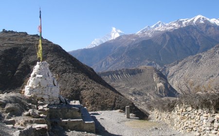
Short, steep and cold. The trail climbs over moraine into the open bowl of the sanctuary, and the last part is usually walked in early morning shade. It is the section where people most often feel the altitude, because there is no forest left to shelter you and no more time to adjust. The reward is the amphitheatre of peaks, and the temperature at dawn is genuinely punishing.
Altitude sickness on the ABC trek: AMS, and the separate HAPE warning signs
Acute mountain sickness is the risk that separates this from a long hill walk in Europe. The CDC Yellow Book chapter on high-altitude illness and guidance from the UIAA Medical Commission describe the same AMS criteria: a headache plus at least one of nausea or vomiting, dizziness, unusual fatigue, or disturbed sleep. Symptoms that stay flat or get worse despite rest are the signal, not something to push through.
Breathlessness at rest is a different list. Along with a persistent cough, gurgling in the chest, or being unable to walk a straight line, it points towards high-altitude pulmonary or cerebral oedema rather than plain AMS. Those are emergencies. Descend and get medical help rather than taking a tablet and continuing.
The same sources stress gradual ascent, avoiding overexertion, and honest self-monitoring. Most standard itineraries on this route gain height steadily, which helps, but the final two days above the treeline are where the margin gets thin. A qualified guide's judgement is worth more than a blog post, including this one.
Cold, cloud and the things people underestimate
Trekkers worry about the climbing and get caught out by the weather. Afternoon cloud funnels up the valley quickly. Rain turns the lower trail greasy. Snow is possible high up well outside the winter months. The difference between a good day and a miserable one is usually a dry layer, a warm hat and an early start rather than leg strength. Our best time to trek to Annapurna Base Camp guide covers month-by-month conditions, and the packing list there is worth reading before you commit to a season.
Annapurna Circuit and Thorong La are a different challenge
The Circuit crosses Thorong La at around 5,416 m, more than a thousand metres higher than base camp, and it spends far longer in remote country away from any road. Its altitude profile and its isolation sit in a different category. Whatever you conclude about the Circuit, do not carry that verdict over to the Base Camp route, and the reverse is equally true.
So is the Annapurna Base Camp trek hard? The honest verdict
Moderate to hard, as multi-day Himalayan treks go. Not technical in the main seasons, not remote in the way the high passes are, but unrelenting on the legs and serious about altitude in the last two days. If you can handle repeated long days on rough ground, accept cold accommodation, give yourself nine or ten days rather than seven, and are willing to turn around or descend when your body complains, the route is well within reach of ordinary hikers.
What's Your Reaction?