









Pumori Climbing Guide: Route, Camps and Safety on the Southeast Face
A practical guide to climbing Pumori (7,161 m) in the Khumbu: what operators expect of you beforehand, the walk in from Gorak Shep, how the southeast face route and camps are usually arranged, the spring and autumn windows, expedition permit basics, and the objective hazards that decide the climb. Meta description suggestion: "Planning Pumori (7,161 m)? What operators expect, the walk in from Gorak Shep, the southeast face route, camp structure, seasons and permits."

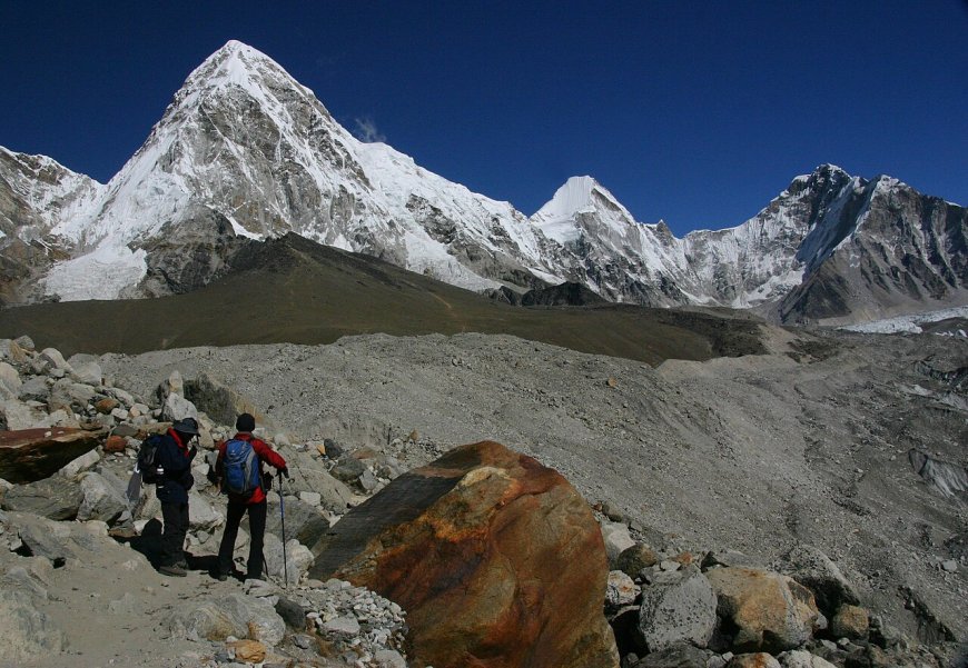
Pumori fills a lot of the sky above Gorak Shep. Plenty of trekkers photograph it without ever learning its name, and far fewer realise it has a real climbing history and a southeast face that asks proper questions of a team. This guide covers the climb itself: what the mountain is, what operators expect of you, how the route and camps are usually arranged, when teams go, and where the danger sits.
Pumori at a glance
Pumori is most often published at 7,161 m. If you want to confirm the figure yourself, the Department of Tourism's list of permitted expedition peaks and the Himalayan Database both carry the peak record.
It stands in the Khumbu, inside Sagarmatha National Park, north-west of Everest and directly above the Gorak Shep and Kala Patthar area. For park boundaries, entry rules and conservation details, the Department of National Parks and Wildlife Conservation (dnpwc.gov.np) is the source to check.
On the name: popular accounts tie Pumori to the 1921 British reconnaissance expedition to Everest and gloss it as "unmarried daughter", which is why you often see the mountain called Everest's daughter. Treat that as a popular account rather than a settled etymology.
As a climb, Pumori is a snow-and-ice ascent for people who are already acclimatised and moving well at altitude. It is not a walk-up, and it is not a first 7,000er for someone arriving straight off a Lukla flight.
Seeing Pumori from Kala Patthar and Gorak Shep
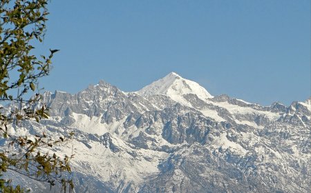
If you are not climbing, the best free view is at sunrise. From Kala Patthar, Pumori sits on the left of the panorama as you face Everest: a broad, snow-covered mass with a distinct summit ridge that catches first light while the Khumbu below is still in shadow. Give yourself the extra hour before dawn and a proper down jacket, because the wait is cold and the light lasts minutes, not hours.
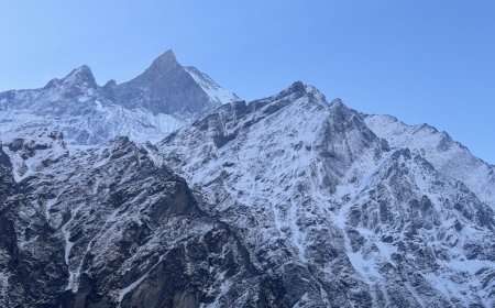
From Gorak Shep the mountain looms much closer and looks considerably more serious, which it is. Standing at the lodges with a cup of tea, you are looking at roughly 2,000 m of face that people spend weeks preparing to climb. It is worth a slow walk up the moraine in the afternoon just to watch the light move across the serac bands.
Prerequisites: what operators expect before Pumori
Pumori operator listings are fairly consistent on this. Most ask for at least one previous 6,000 m-plus ascent, comfort moving on fixed rope, and solid crampon and ice-axe technique. Some want a 7,000er or Ama Dablam on your record before they will take the booking. Nobody serious markets it as an entry-level altitude expedition, and a team that does is worth a second look at.
If you are building towards Pumori, Island Peak and Lobuche East are the usual stepping stones in the Khumbu, and either one gives you the fixed-rope and crampon mileage that a Pumori team will want to see.
The walk in to Pumori base camp
Almost every Pumori team arrives on foot, following the Everest trail through the Khumbu. Gorak Shep is the last lodge, and from there it is a short walk out onto the moraine below the face to reach base camp. Short, yes. Easy, no: you are above 5,000 m, carrying a load, and that stretch is the first real acclimatisation test of the trip. Teams that rush it usually pay for it higher up.
The days, teahouses and acclimatisation pattern on the approach belong to our Everest Base Camp trek guide, so we won't repeat them here.
Pumori southeast face route
The line most parties describe leaves base camp on the Khumbu Glacier side and gains the southeast face, working through snow slopes and around serac bands before the upper face and the summit slopes. Steeper sections are protected with fixed rope, generally fixed by the team's own Sherpa staff. Cornices on the upper face dictate where you can and cannot traverse, and they shift through the season.
Grades are where you should be careful. Operators advertise Pumori across a range and describe the difficulty differently, so ask two or three agencies for their own written description of the route and compare before you commit.
Pumori camps and itinerary length
The typical shape is a base camp on the moraine, then two higher camps on the face: Camp 1 on the lower snow slopes, Camp 2 higher up, with the summit push launched from Camp 2. Some teams use only one high camp; others add a camp or spend extra nights rotating between them. Total nights on the mountain depend on conditions and on how the team is acclimatising.
That is a mental model to ask questions against, not a fixed plan. Before booking, ask how many camps the team intends to use, where they sit, how many nights on the face, what happens if the face is loaded with snow, and who makes the call to turn around.
When teams climb Pumori
There are two windows. Spring, roughly late March to May, before the monsoon arrives, and autumn, roughly late September to November, after it has passed. Spring teams often deal with more snow on the face; autumn is generally colder and firmer but the days are shorter. Winter and monsoon ascents are rare and outside what a commercial team will offer you.
Conditions vary year to year, and a good spring one year tells you little about the next. Plan around the season, then trust your operator's current report and the forecasts on the ground over anything written months in advance.
Objective hazard on Pumori
Seracs and cornices sit above the climbing line, and avalanche runout reaches parts of the lower face and the approach. Snow conditions on the upper slopes can change within a day. Altitude is the other constant: base camp sits high, and the summit push is long. The Himalayan Database is where recorded ascents and accident history on the peak live, if you want to read up before you go.
Permits and paperwork
Pumori is an expedition peak. That means a mountaineering permit from the Department of Tourism, not an NMA trekking-peak permit, and the two carry different fees and different processing. On top of that you need Sagarmatha National Park entry and the local rural municipality fee, both usually handled by your agency. Fees change, so confirm the current numbers with the Department of Tourism (tourism.gov.np) close to departure and ask your agency exactly what is included.
Judgement and safety
Fixed ropes make steep ground manageable. They do not make it safe. The decisive factors on Pumori are acclimatisation, a weather window that actually holds, and a team willing to walk away when it doesn't.
Sort out rescue and evacuation cover with your insurer directly, and read the altitude and climbing exclusions carefully, because helicopter evacuation off the upper face is not the same as a trekking evacuation. Guides can tell you what a policy needs to cover; they cannot decide it for you.
Come prepared, come early in the season, and treat the summit as optional. That is the attitude that gets people up Pumori and, more importantly, back down.
What's Your Reaction?