





GLOFs in Nepal: Who Monitors Himalayan Lakes, and Who Decides
This article traces how Nepal monitors, assesses, and responds to glacial lake outburst floods (GLOFs).

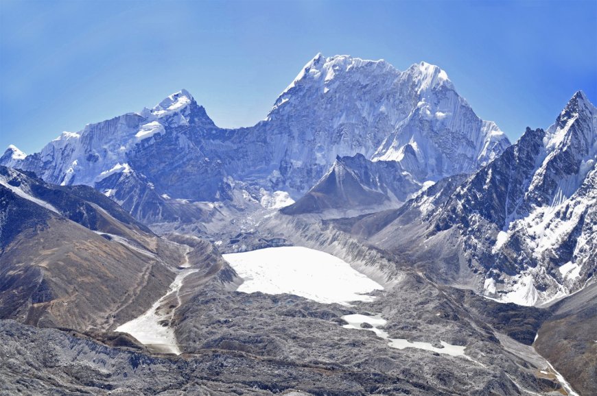
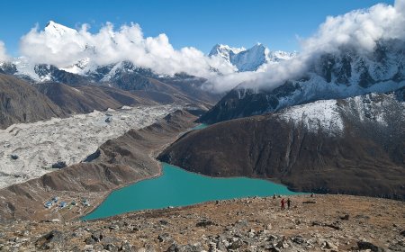
When a glacial lake bursts in the Himalaya, the water does not wait for a committee meeting. It rushes down valleys carved by ice, taking bridges, hydropower intakes, and sometimes entire settlements with it. In Nepal, the acronym GLOF has moved from academic papers into district disaster plans, yet the chain of decisions — who measures a lake, who judges it dangerous, who authorizes lowering works, and which warning reaches a village downstream — remains opaque to most people living in its path. This piece follows that chain from satellite sensor to siren, drawing on the Department of Hydrology and Meteorology (DHM), the International Centre for Integrated Mountain Development (ICIMOD), and the National Disaster Risk Reduction and Management Authority (NDRRMA), the body established under the Disaster Risk Reduction and Management Act, 2074 (2017) and housed under the Ministry of Home Affairs. For a plain‑language explanation of the phenomenon itself, see our GLOF explainer.
Glacial lake monitoring in Nepal: sensors, inventories, and who holds the data
Glacial lake monitoring in Nepal relies on a mix of satellite imagery, field surveys, and automated sensors. DHM maintains the operational glacier and glacial lake inventory, updated most recently in 2020 with ICIMOD support. That inventory mapped 2,070 glacial lakes larger than 0.02 square kilometres across the country's major basins and classified 21 of them as potentially dangerous based on moraine‑dam condition, lake expansion rate, and downstream exposure. The inventory is a periodic assessment, not a live dashboard. Real‑time water‑level data come from a handful of instrumented lakes — Tsho Rolpa, Imja Tsho, and Lower Barun among them — where DHM has installed radar or pressure‑transducer stations that transmit via GSM or satellite modem. The raw feeds sit on DHM's internal server; processed bulletins go to NDRRMA and to the Ministry of Energy, Water Resources and Irrigation when hydropower assets are involved. There is no single public portal that shows every lake's current status today. For how warning products are issued from these feeds, see our DHM flood warning service piece.
Glacial lake lowering in Nepal: who decides, who funds, who executes
Glacial lake lowering decisions follow a multi‑step clearance. DHM's technical committee assesses hazard level using the inventory criteria. If a lake crosses the "high risk" threshold, the report goes to NDRRMA, which convenes a cross‑ministerial review including the Department of Water Resources and Irrigation, the Ministry of Forests and Environment, and, where infrastructure is at stake, the relevant hydropower developer. Funding has historically come from the government's disaster management budget supplemented by bilateral partners — the Tsho Rolpa lowering (1998–2002) was backed by the Netherlands and UNDP; the Imja Tsho works (2014–2016) drew on Global Environment Facility funds channeled through UNDP and DHM. Execution is typically awarded to the Nepal Army's engineering wing or a qualified contractor under DHM supervision. As of October 2026, structural lowering has been completed at Tsho Rolpa and Imja Tsho; work is underway at Thulagi with Green Climate Fund support, while Lower Barun remains at the design stage. The number of lakes assessed as requiring intervention is still larger than the number treated.
DHM flood warning in Nepal: from sensor to siren
DHM flood warning operates on a tiered protocol. When a monitored lake exceeds preset water‑level or rate‑of‑rise thresholds, the DHM station sends an automated alert to the Kathmandu forecasting office. Duty officers verify against weather radar and, if needed, call the field caretaker. A confirmed warning triggers NDRRMA's district‑level dissemination: SMS to local disaster management committees, radio interrupts on community FM stations, and, in pilot basins, siren arrays installed at downstream settlements. The system was tested during the 2021 monsoon when heavy rainfall coincided with high lake levels at Tsho Rolpa; alerts reached Dolakha district officials promptly after the threshold breach. Gaps remain: not all high‑risk lakes have real‑time telemetry, and last‑mile coverage in remote valleys depends on VHF radio networks maintained by district police. Our coverage of hydropower and landslide disasters details how operators integrate these feeds into turbine shutdown procedures.
Transboundary glacial flood risk: Nepal and China
A 2019 memorandum of understanding between DHM and China's Ministry of Water Resources established a framework for seasonal hydrological data exchange on the Koshi, Gandaki, and Karnali basins, according to the DHM annual report 2022 (the latest publicly released). The agreement covers seasonal water‑level and rainfall sharing at designated stations. It does not, however, specify a joint GLOF early‑warning protocol or real‑time alerting for lakes on the Tibetan side that drain into Nepal — such as Gangxi Co and Jialong Co in the Poiqu/Bhote Koshi headwaters. ICIMOD's 2021 transboundary assessment notes that Chinese authorities operate monitoring on several Tibetan lakes but that data‑sharing frequency and threshold definitions remain bilateral negotiation items. Until a signed protocol with defined lead times and communication channels is published, downstream communities in Sindhupalchok and Rasuwa rely on national systems alone.
What it means for a resident, a trekker, and an operator
In a village like Thame in the Khumbu, the 1985 Dig Tsho outburst — which killed at least four people and destroyed the nearly completed Namche small hydropower plant — is living memory. Today, residents receive SMS alerts from NDRRMA but often learn of rising water first from herders upstream. For trekkers, the risk is seasonal: pre‑monsoon and monsoon months coincide with peak lake volumes. Our trekking safety guide recommends registering with the Trekking Agencies' Association of Nepal checkpoints and carrying a satellite messenger in valleys below known hazardous lakes. Hydropower operators, meanwhile, have begun embedding DHM's lake‑level APIs into SCADA systems; the 456 MW Upper Tamakoshi project runs automated turbine‑trip logic tied to Tsho Rolpa telemetry. None of these measures eliminates the hazard; they only buy minutes.
Lessons from the Andes
Peru's Cordillera Blanca has managed glacial lake outburst flood risk since the 1940s, pioneering syphon‑based lowering at Lake Palcacocha after a 1941 disaster killed 1,800 people in Huaraz. That program, now run by the National Water Authority (ANA) with World Bank support, monitors over a dozen lakes with real‑time telemetry and conducts regular evacuation drills mandated by national regulations, according to ANA and World Bank reports (2022). Nepal's system is still building toward that level of maturity.
Recent event: the August 2024 Thame GLOF
In August 2024 a sudden outburst from Thame glacial lake (Thame Tsho) in the Khumbu region sent a debris‑laden flood down the Thame River, damaging several pedestrian bridges, a section of the Everest Base Camp trekking trail, and a small community hydropower unit. NDRRMA issued SMS and FM radio alerts within minutes of the first reports, but the lake lacked real‑time telemetry, so the warning relied on eyewitness calls from herders. The event prompted DHM to accelerate sensor installation at Thame and to prioritize telemetry upgrades for other high‑risk lakes that currently have only periodic field checks.
Verification and uncertainty
Lake counts, hazard classifications, and project statuses cited here reflect DHM and ICIMOD publications accessed in September 2026; the NDRRMA mandate is confirmed from ndrrma.gov.np as of the same period. The DHM annual report for 2024 is the latest publicly released version. Figures carry their own as‑of framing because inventories are updated irregularly and lowering projects shift with budget cycles. No specific future outburst is predicted, and no lake is ranked by potential casualties. Figures last verified 3 October 2026.
What's Your Reaction?