








Sunsari District, Koshi Province: Geography, Cities and Local Levels
Sunsari District in Koshi Province spans 1,257 km² with a 2021 census population of 926,962. It comprises 12 local levels including the sub‑metropolitan cities of Dharan and Itahari, and hosts part of the Koshi Tappu Wildlife Reserve.

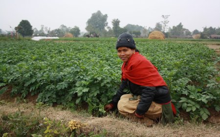
Sunsari District sits in the southeastern stretch of Koshi Province, where the flat Terai plain meets the first rise of the Siwalik hills. It borders Morang to the east, Udayapur and Dhankuta to the north, Saptari across the Koshi River to the west, and the Indian state of Bihar to the south. The Koshi forms a natural boundary with Saptari before cutting south across the border, a geography that has shaped settlement, agriculture and transport for generations.
Major urban centres in Sunsari
Three cities dominate the district's economic and social life. Dharan, on the foothills, grew around a British Gurkha recruitment depot and later became an education and health hub for the eastern region. Itahari sits at the junction of the Mahendra and Koshi highways, making it a natural logistics and trade centre. Inaruwa, the district headquarters, occupies a more central position on the plain and hosts the main administrative offices.
Sunsari's local levels: municipalities and rural municipalities
After the 2017 federal restructuring, Sunsari is divided into 12 local levels — six municipalities and six rural municipalities. The urban municipalities are Dharan (sub‑metropolitan), Itahari (sub‑metropolitan), Inaruwa, Duhabi, Ramdhuni and Barahakshetra. The rural municipalities are Bhokraha Narsingh, Koshi, Gadhi, Barju, Harinagar and Dewanganj. Each local level has an elected chairperson or mayor, a deputy, and ward chairs; wards are the smallest administrative unit, numbering between 5 and 33 per local level depending on population and geography. The sub‑metropolitan threshold under the Local Government Operation Act 2074 is a population of at least 100,000 plus a prescribed revenue floor, not the higher figure sometimes quoted.
Area and population
Sunsari covers 1,257 square kilometres. The 2021 National Population and Housing Census conducted by the Central Bureau of Statistics recorded a population of 926,962, making it one of the more densely populated districts in the province. The district also contains a significant portion of the Koshi Tappu Wildlife Reserve, a Ramsar site known for migratory waterbirds and wild water buffalo.
Official sources
For the most current boundary maps, ward‑level data and administrative contacts, start with the Ministry of Federal Affairs and General Administration at mofaga.gov.np. The District Coordination Committee Sunsari also publishes updates; its site can be reached via the MoFAGA portal. Postal codes and ward‑by‑ward breakdowns are maintained by Nepal Post and the respective local levels.
What's Your Reaction?