




Temperature at the Top of Mount Everest: Why the Summit Isn't Just Base Camp Minus a Few Degrees
What it's really like at the top of Mount Everest, why the textbook lapse rate only gets you partway, and why no permanent summit weather station exists.

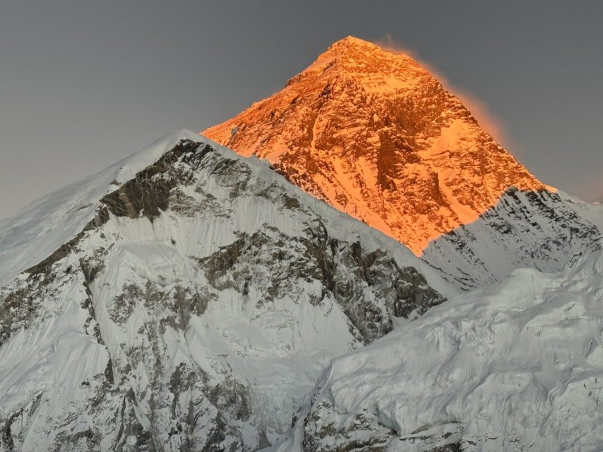
Ask what the temperature is at the top of Mount Everest and someone will give you a number with total confidence. Ask where that number came from and the confidence tends to sag. Both reactions make sense. The summit is cold in every season and nobody serious argues otherwise. The exact figure moves around with the day, the wind, and the method used to estimate it, and the reasons it moves are more useful than any single reading.
Base camp minus a bit doesn't survive contact with the mountain
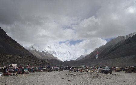
Standard atmosphere cools at roughly 6.5°C for every 1,000 metres of height gain. That's a textbook constant and it is deliberately idealised. Run it across the roughly 3,500 metres between Everest base camp and the summit and you get somewhere in the low twenties of degrees of cooling. As a first guess it's fine. As a summit forecast it's not worth much.
The summit isn't a thermometer sitting quietly in a well-mixed column of air. It's a pointed ridge shoved into the jet stream for much of the year, and the air passing over it has come from somewhere else entirely, often after crossing the Tibetan plateau. Wind, cloud, sun angle and the texture of the snow surface all push the real reading away from the clean arithmetic. A windy overcast afternoon and a still, brilliantly sunny morning at the same height can feel like two different mountains.
A year at the summit, roughly
Winter is the deep cold. The jet stream sits over the Himalaya and the upper mountain is scoured by wind that makes the air temperature almost a side issue. Very few people go up, which is why winter summit readings are thin on the ground.
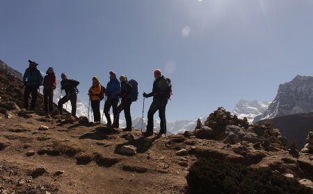
Spring brings the climbing window. In a typical year the jet stream drifts north in the second half of May and a short gap opens. It stays cold up there, and the wind chill still does the damage, but the difference between late April and late May on the south side is the difference between a marginal attempt and a possible one. The most recent completed pre-monsoon season, spring 2026, followed that familiar shape.
The monsoon is warmer and snowier, with lighter winds and a lot of new snow. Almost nobody climbs. Autumn gives a second, shorter window in some years before the cold and wind close back in.
Wind and thin air do most of the work
Air pressure at the summit is approximately a third of what it is at sea level, and that single fact explains a great deal about the place. Each breath carries far less oxygen, which is why the ground above 8,000 metres picked up the name death zone. It also means the air holds very little water vapour and shifts temperature quickly.
Wind is the part that actually bites. A moderate summit wind strips heat off exposed skin far faster than the air temperature alone would suggest, and frostbite on the upper mountain is a wind story more than a thermometer story. You will see wind chill charts quoted for Everest, and they are useful in spirit, but treat any precise figure attached to a generic wind speed with suspicion.
How anyone knows what it's like up there
There is no permanent summit weather station run by a national weather service, and it's worth stating that clearly because the internet often implies otherwise. The best-known long-running high-altitude observatory in the region sits near Lobuche, a little above 5,000 metres. That's genuinely high and genuinely useful for understanding the Khumbu, but it is still roughly 3,800 metres below the top.
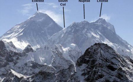
Above that, the record is patchy and comes in pieces. Research expeditions have installed automatic weather stations on the upper mountain, including a reported installation at the South Col in 2019, and those units are built to survive conditions that destroy ordinary instruments. They give short stretches of data, sometimes with gaps. Climbers' own observations fill in the rest, and while a guide's note that it was brutal at the Balcony is not a calibrated measurement, it is not nothing either. Satellites and reanalysis models add the wider picture, with the usual caveats about resolution over sharp terrain.
For reference on height itself, the summit stands at 8,848.86 metres, the joint Nepal–China figure announced in December 2020. That announcement is a fixed point; the temperature above it is not.
What the cold is doing to the mountain
Freeze-thaw cycles pry at rock, snow gets moved around by wind rather than falling evenly, and ice surfaces change shape from one season to the next. Anyone who has read two accounts of the same route from different years will have noticed they describe different mountains. None of that requires a number to be true, which is part of the point: the processes are well understood even where the exact temperature at a given hour is not.
The honest answer
Summit temperature is best described as a range that depends on season and on the day, and the range is wide. Cold enough that frostbite is a live risk in the climbing window, colder still in winter, and always made worse by wind. If you came for a single figure, the more truthful version is that the figure is approximate, dated, and tied to a specific measurement rather than to the mountain in general.
What's Your Reaction?