


Shey Phoksundo Lake Trek Access: Getting from Kathmandu to Ringmo
A practical look at how the Kathmandu–Nepalgunj–Juphal–Dunai–Ringmo chain actually works for the Shey Phoksundo trek, where each link tends to fail, and what to do when it does. Permits and cash are covered without quoting fee figures that change and cannot be verified from here.

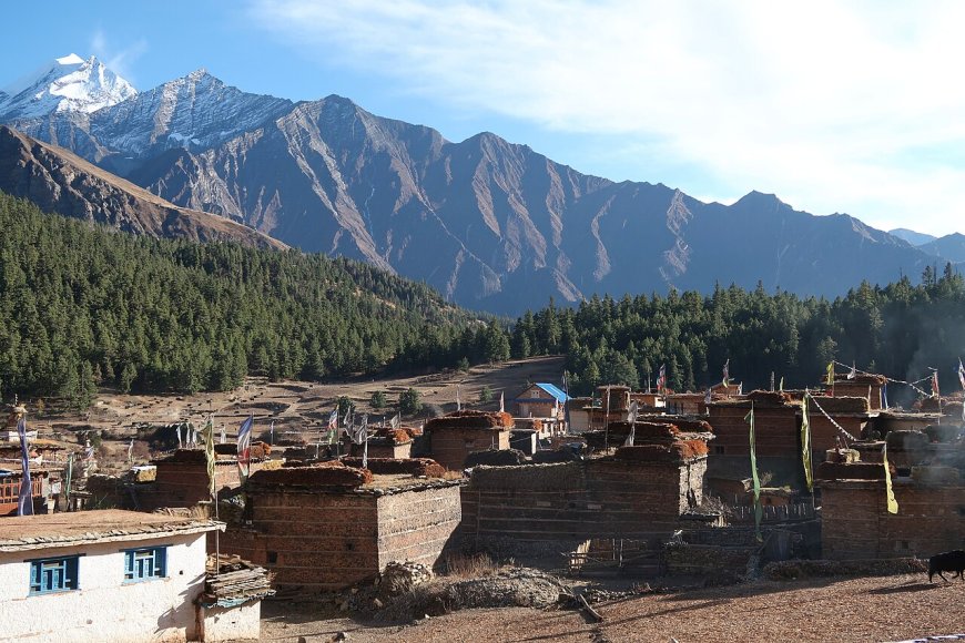
The Shey Phoksundo trek runs on a chain of links between Kathmandu and Ringmo, and the chain is only as strong as its weakest morning. The spine itself is simple: reach Nepalgunj, fly to Juphal, walk down to Dunai, then climb to Ringmo. What follows is where each link tends to break, and what you can realistically do about it.
Kathmandu to Nepalgunj
Buddha Air, Yeti Airlines and Shree Airlines all fly the KTM–KEP sector, a little over an hour in the air. Buses and private jeeps on the East-West Highway take roughly 12 to 16 hours when nothing goes wrong, and between the Butwal–Kohalpur widening works and monsoon landslides, nothing going wrong is not something to count on. Ask at the Nepalgunj bus park or check Department of Roads updates on the morning you travel instead of trusting a timetable posted the week before.
Nepalgunj to Juphal
This is the link that decides trips. Tara Air and Summit Air fly Twin Otters on the roughly 35-minute sector under visual flight rules, so departures bunch into the early morning. When cloud sits on the Dolpo ridges or the crosswind at Juphal picks up, the schedule just stops. There is no published combined reliability figure for the two carriers worth quoting, so plan for the possibility rather than the average: one cancelled morning is routine, and two or three in a row happens, particularly at the tail end of the monsoon and again in winter.
No road reaches Juphal. If flights stay down for long, the overland exit runs through the Karnali corridor toward Surkhet, five to seven days of walking that almost nobody on a fixed return ticket can absorb. Two buffer nights in Nepalgunj, or at Dunai on the way out, is the cheapest insurance on the whole route.
Juphal to Dunai
The airstrip sits above the Thuli Bheri valley, and the walk down to Dunai takes three to four hours on a mule track that has been widened in places over the years. Porters and mules can be arranged at the strip. The winter hazard is ice on the shaded switchbacks above the river, which is where microspikes earn their weight in December and January.
Road building has been creeping up the Thuli Bheri for years and the situation shifts season to season, so ask locally whether a jeep now covers part of the leg. Don't build an itinerary around a road that may or may not be there when you arrive.
Dunai to Ringmo
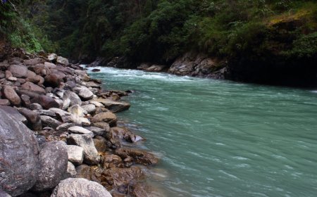
Two to three days following the Suli Gad inside the national park: Dunai up to Chhepka, then on to Ringmo, with the altitude building slowly until the last stretch above the Phoksundo Khola. That final approach crosses a landslide-prone slope and is the piece to watch after heavy rain.
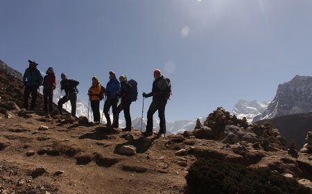
From late November into March, fresh snow above roughly 3,500 m can hide the trail and load the north-facing bowls below Kanjirowa. Reasonable turnaround markers are deep fresh snow on the Ringmo approach, or collapsing snowpack and shooting cracks on those slopes. There is no winter helicopter based at Juphal for rescue, and the nearest SAR base is at Surkhet, which is a very long way from where you would be.
When a link fails
- KTM–KEP flight cancelled: take the highway bus and lose a day.
- KEP–Juphal grounded for more than 48 hours: either wait it out with a hard abort date agreed in advance, or reroute via Surkhet and Jumla, which adds a week or more of walking.
- Ice on the Juphal–Dunai descent: wait for the sun to soften it, or put the spikes on.
- Dunai–Ringmo snowed in: turn around. A lake is not worth a rescue.
Permits
Ringmo sits inside Shey Phoksundo National Park, so a national park entry permit is required. Routes that continue beyond Ringmo into upper Dolpo fall under restricted-area rules and need a permit arranged through a registered trekking agency, with the paperwork done before you leave Kathmandu. Fees and the exact boundary of the restricted zone are set by the Department of National Parks and Wildlife Conservation and are revised from time to time. Confirm the current permit list and fee with your agency before you book international flights.
Connectivity and cash
Ncell and Nepal Telecom signals reach Juphal and Dunai patchily; Ringmo has nothing you can rely on. Carry all the rupees you need for the Dolpo leg, because the last ATM is in Nepalgunj. Satellite messengers work on the ridgelines and drop out in the gorge between Chhepka and Ringmo.
None of this is meant to talk you out of the trek. It is meant to stop you from discovering the chain's weak link on the morning you are standing at the Nepalgunj check-in desk.
What's Your Reaction?