



Trekking in Nepal in October 2026: Route, Permit & Safety Checklist Before You Book
October is Nepal's most popular trekking month, but the season shifts fast from warm post-monsoon days to snow on the high passes, and festival travel plus lingering landslide damage can change your plans. This guide covers which official sources to check, how permits and restrictions work for the main regions, and what to settle on altitude, guides and insurance before you pay a deposit.

Trekking in Nepal in October 2026: Route, Permit & Safety Checklist Before You Book
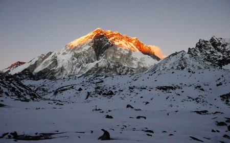
October is the month most trekkers aim for in Nepal, and it earns the reputation. The monsoon has usually pulled out, the haze washes off the mountains, and the trails have had weeks to dry out. The mistake people make is treating October as one block. It isn't. Early in the month you walk through post-monsoon green with warm days and long views. By the final week, high passes are catching their first proper snow and nights above 4,000 m are seriously cold.
Two other things shape an October trip. The autumn festivals, Dashain and Tihar, fall inside this window, so domestic flights, buses and teahouses get busier with Nepali travellers heading home to family. And the tail end of the monsoon can leave damage behind. Landslides in the lower Marsyangdi valley and along other road-and-trail corridors sometimes take weeks to clear. If you want a quiet, easy trail, October is not the month for it.
Where to check, and how to read what you find
There is no single government page that tells you "your trail is open". You'll end up reading a handful of different websites, and the useful habit is to look at the date on whatever you're reading, because a notice from three weeks ago may already be out of date.
- Department of Hydrology and Meteorology (DHM) for weather forecasts and flood bulletins. Each release carries a validity window, so check that line first.
- Department of National Parks and Wildlife Conservation (DNPWC) for national park permits, including Sagarmatha, Langtang and Bardia.
- National Trust for Nature Conservation (NTNC), which runs the Annapurna Conservation Area Project (ACAP) office in Pokhara.
- Nepal Tourism Board (NTB) and TAAN for TIMS cards and rules on trekking agencies.
- Department of Immigration for restricted-area permits.
- NDRRMA for larger hazard alerts, such as major landslides or glacial lake warnings.
Government sites here don't always update on a schedule you'd like, and some still post notices as scanned PDFs with no searchable text. If a page looks abandoned, phone the office or ask a registered trekking agency to confirm the position in writing before you commit money.
Route status: don't assume last season carries over
Trail conditions change after a heavy rain spell or a fresh rockfall. Bridges wash out, and a detour that worked in spring may have been repaired by autumn or closed again. Check the protected-area office for your region, and the Mines and Geology portal for anything geology-related.
Some offices publish a simple open or closed flag for a main corridor. Others put out longer notices describing bridge repair or landslide clearance. Where a restriction exists, note who issued it and when. That's the detail that matters if you need to change a booking or explain a route change to your insurer later.
Permits: what you need and where to get it
| Permit | Issued by | Where to apply | Notes |
|---|---|---|---|
| TIMS card | NTB / TAAN | NTB office, Kathmandu; TAAN offices in Kathmandu and Pokhara | Required for most non-restricted treks. Rate differs for SAARC-country nationals, and there are exemptions, so check the current schedule. |
| ACAP permit | NTNC | ACAP office, Pokhara; also available through NTB in Kathmandu | Annapurna region: Circuit, Base Camp, Poon Hill, Mardi Himal and others. |
| Sagarmatha National Park entry | DNPWC | DNPWC office, Kathmandu; park gate at Monjo | Khumbu treks. The local rural municipality also collects its own fee, usually on the trail. |
| Langtang National Park entry | DNPWC | Kathmandu; checkpoints at Dhunche and Sundarijal | Langtang Valley, Gosainkunda, Helambu. |
| Restricted-area permit | Department of Immigration | Kathmandu, through a registered Nepali agency only | Upper Mustang, Upper Dolpo, Manaslu, Tsum, Nar Phu, Kanchenjunga and similar areas. |
I've deliberately left the amounts out. Permit fees are revised by the issuing body, and a number copied off a blog post is exactly how people end up at a counter with the wrong amount of cash. Look up the current rate in the week you plan to pay, and carry rupees rather than expecting to use a card.
Restricted-area permits work differently from the rest. They're tied to fixed dates on your itinerary, they generally require a government-licensed guide, and most areas require a minimum of two trekkers rather than a solo permit. Your agency handles the paperwork, but you need to give them accurate dates well ahead, because changes after issue are rarely free.
Weather, snow and high passes
Thorong La on the Annapurna Circuit and Larkya La on the Manaslu circuit are the two passes most affected by an October snow shift. Both sit above 5,000 m, and once snow starts settling in late October, crossings get slower and the window narrows. On any given morning, a pass can be perfectly walkable; two days later it can be a different proposition.
DHM puts out forecasts and flood warnings covering the major river crossings, which matters for the Dudh Koshi, the Marsyangdi and the Trishuli. Treat high-altitude forecasts as a rough guide rather than gospel. They're not especially reliable above 4,000 m, so ask at the lodge or with your guide about what people actually encountered the day before. Word of mouth on the trail often beats the model output.
Altitude, guides and insurance
Above 3,500 m the risk of acute mountain sickness climbs quickly, and the fix is time, not fitness. Build in acclimatisation days, ascend slowly past 3,000 m, and be ready to descend if symptoms don't improve.
Guide rules have moved around in recent years. Restricted areas have long required a licensed guide. For other regions, proposals to make guides mandatory have been floated and then adjusted, so check with NTB shortly before you travel rather than trusting an old forum thread. If you do hire a guide, use someone registered, not a person who approaches you in Thamel.
Insurance is the part people skip. Many trekking policies exclude activity above a stated altitude unless you've declared it, and some will not pay for helicopter evacuation if you were travelling without the required permits. Read the wording, find the altitude ceiling and the mountaineering exclusion, and if anything is unclear, get it confirmed in writing by the insurer before you buy the policy.
Pre-trip checklist
- Weather and flood bulletin for your region, checked close to departure.
- Trail or park notice for your specific route, with the issue date noted.
- Permits confirmed: TIMS, conservation area or national park, restricted area if relevant.
- Cash in rupees for permit counters and trail checkpoints.
- Insurance policy: altitude ceiling, evacuation cover, guide clause.
- Festival dates checked, so you know when buses and teahouses will be busiest.
- Acclimatisation days built into the itinerary, not squeezed in at the end.
- An alternative lower route picked in advance, in case a pass closes.
Making the call on your booking
None of this is meant to talk you out of October. It's a genuinely good month to be in the mountains, and the crowds thin noticeably after the festivals. What it does mean is that you should hold your plans a little loosely. If a pass has just taken fresh snow, a bridge on your route is out, or your policy won't cover the altitude you're aiming for, shifting to a lower route or pushing the trip back a week is a sensible decision, not a failure.
Book the flights and the permits you can control. Leave the high passes to the days the mountains allow.
What's Your Reaction?